The app/Site tools
Work on the real lot plan.
Measure it and place a building on it, on the lot’s own boundary with every side’s length.
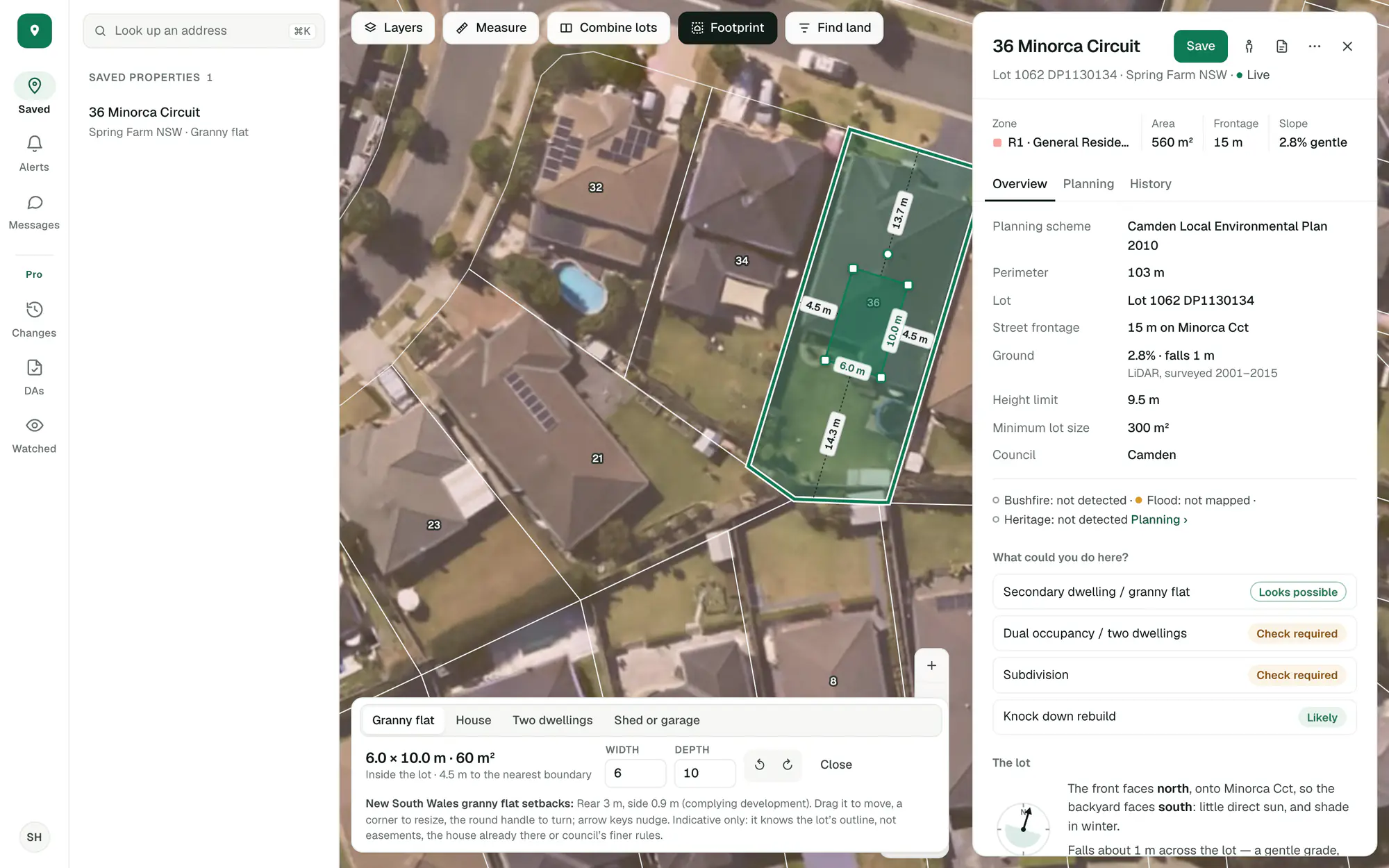
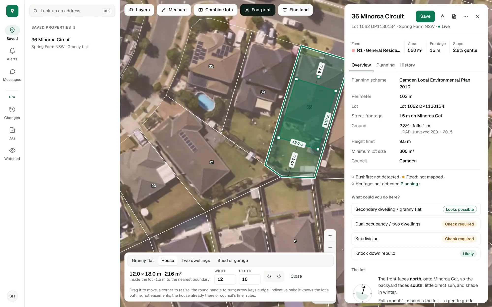
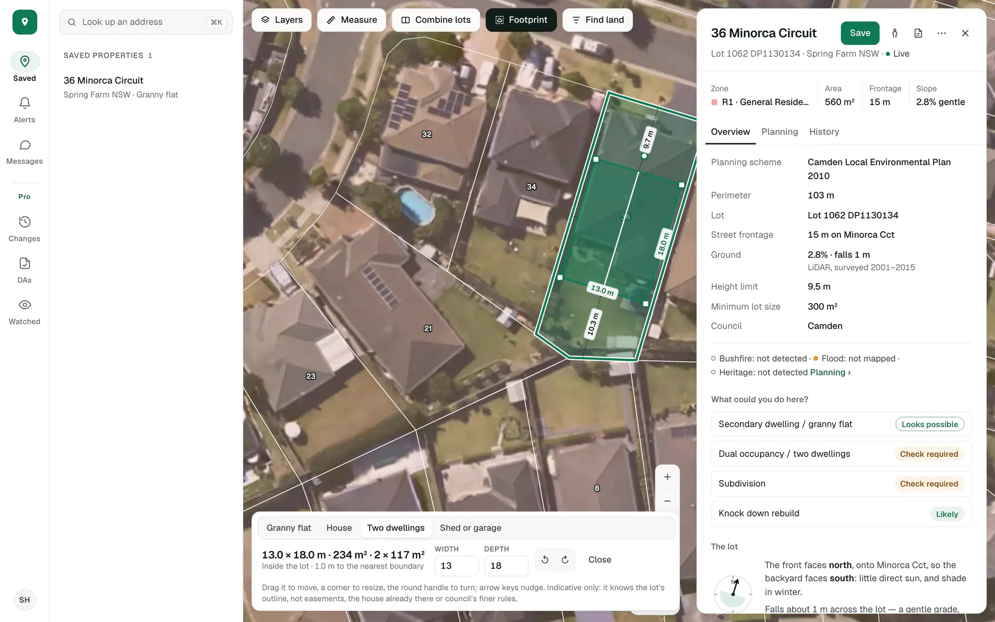
Footprint on a 560 m² lot: a granny flat, a house, then two dwellings. Imagery © State of NSW (Spatial Services, DCS), CC BY 4.0.
Each side of the lot labelled to a tenth of a metre, its perimeter and its area.
Street frontage and the street it is on, which way it faces, slope, easements and strata, where the state publishes them.
Keep a measurement and it is there next time, beside the property it belongs to.
Will it fit?
Choose a granny flat, a house, two dwellings or a shed or garage, set its width and depth, drag it where you want it and turn it. The bar tells you whether it sits inside the lot and how far it is from the nearest boundary.
- On this lot: 6 × 10 m, inside the lot, 4.5 m to the nearest boundary
- The state’s setbacks quoted underneath
- Indicative only: it works from the lot’s outline, without easements, the house already there or council’s finer rules
Imagery © State of NSW (Spatial Services, DCS), CC BY 4.0.
Measure anything.
A line for a setback or a driveway, an area for a backyard or a pad. Points snap to lot corners, and every edge shows its length as you draw.
- Lines and areas
- Snaps to lot corners
- Save it with the property
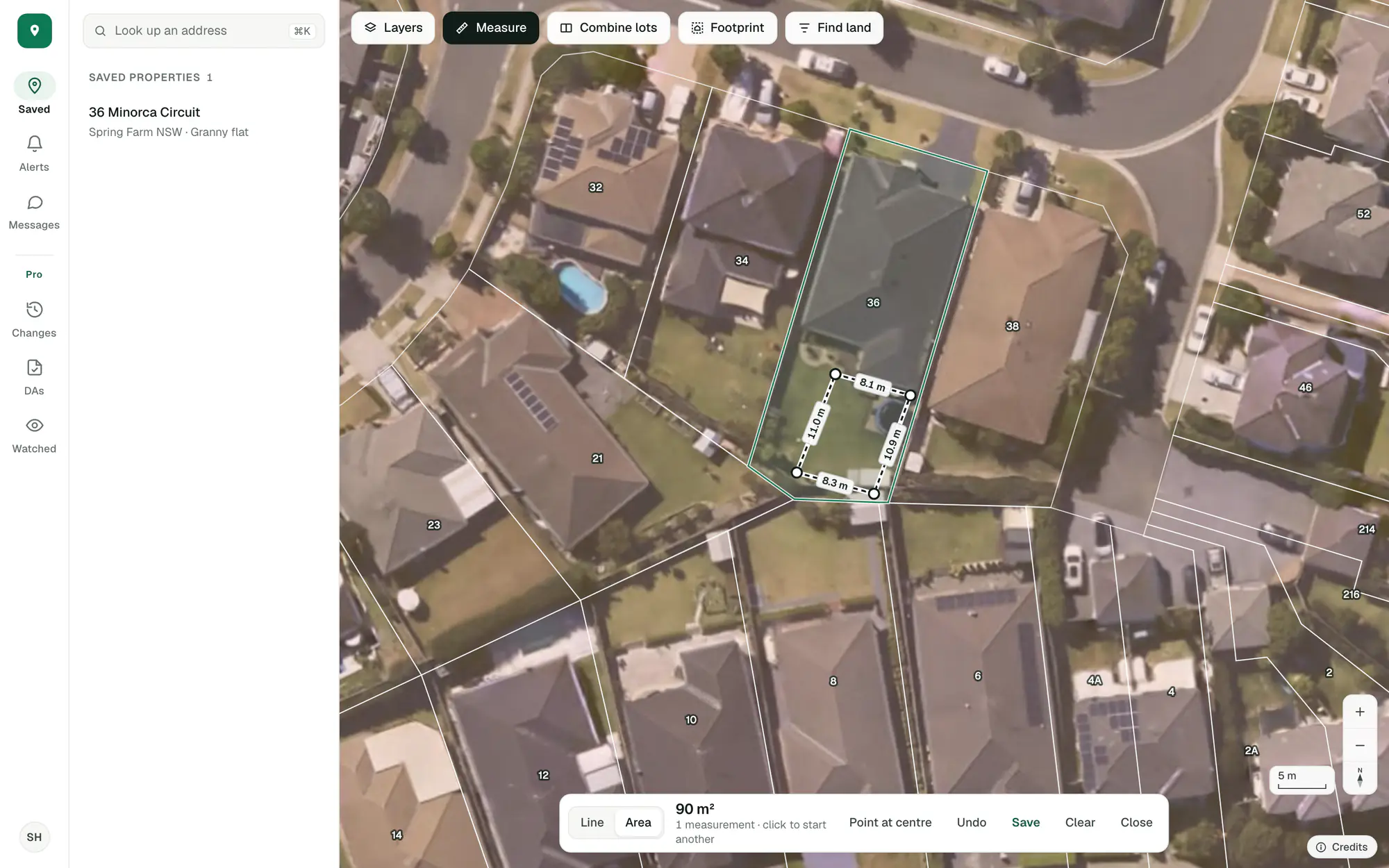
Imagery © State of NSW (Spatial Services, DCS), CC BY 4.0.
Everything about the lot in one panel.
The zone and the planning scheme it comes from, the area, the frontage and which street it is on, the fall across the ground from LiDAR, and in NSW the height limit and minimum lot size.
- Which way the backyard faces, in plain words
- Bushfire, flood and heritage as each is mapped
- Checked against the live planning services
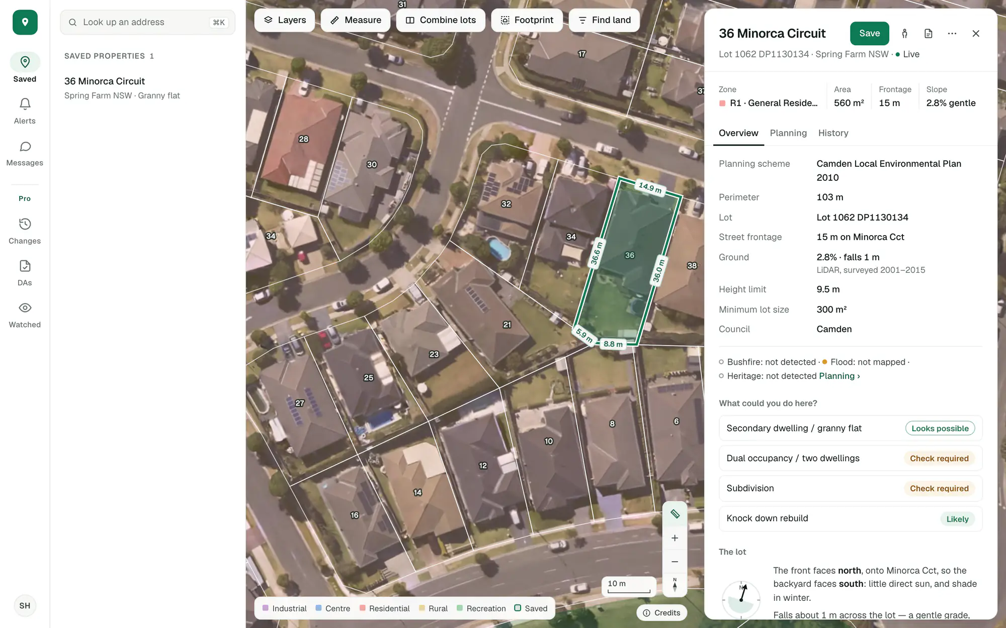
Imagery © State of NSW (Spatial Services, DCS), CC BY 4.0.
Combine or split lots with Pro.
Pro reads adjoining lots as one site and cuts a site into parts, with each part’s area and street frontage beside the minimum lot size.
Combine or split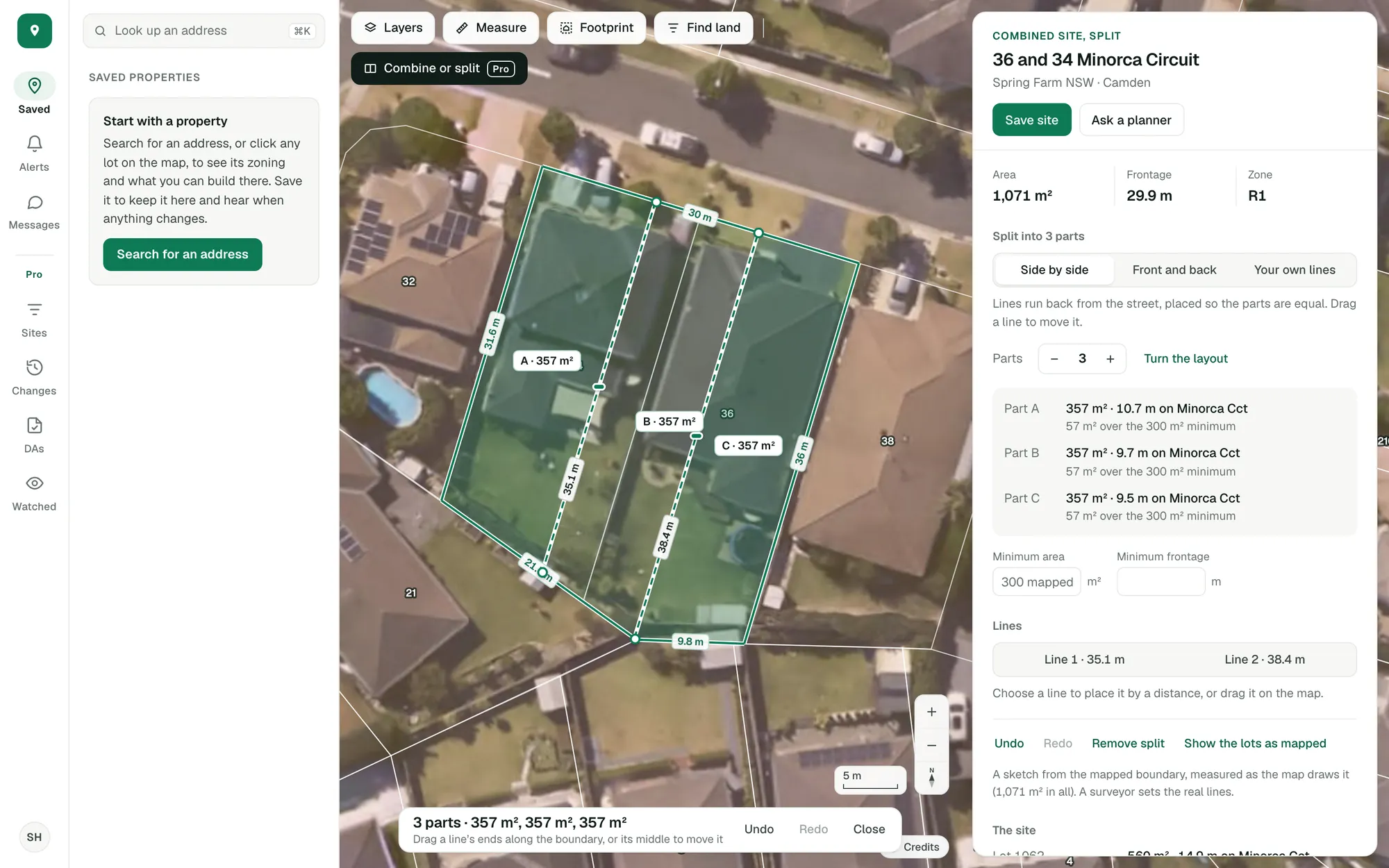
Imagery © State of NSW (Spatial Services, DCS), CC BY 4.0.
Measure and Footprint are in the free account. Combining and splitting lots is Pro.
Start with the lot you’re looking at.
Free, in a minute, with just your email.
General guidance only. ZoneScout reads published government planning data and summarises published standards. It isn’t professional planning advice.