Look it up
Type an address or click any lot on the map. Its zone, size, street frontage and slope come up with what you could do there, checked against the live planning services.
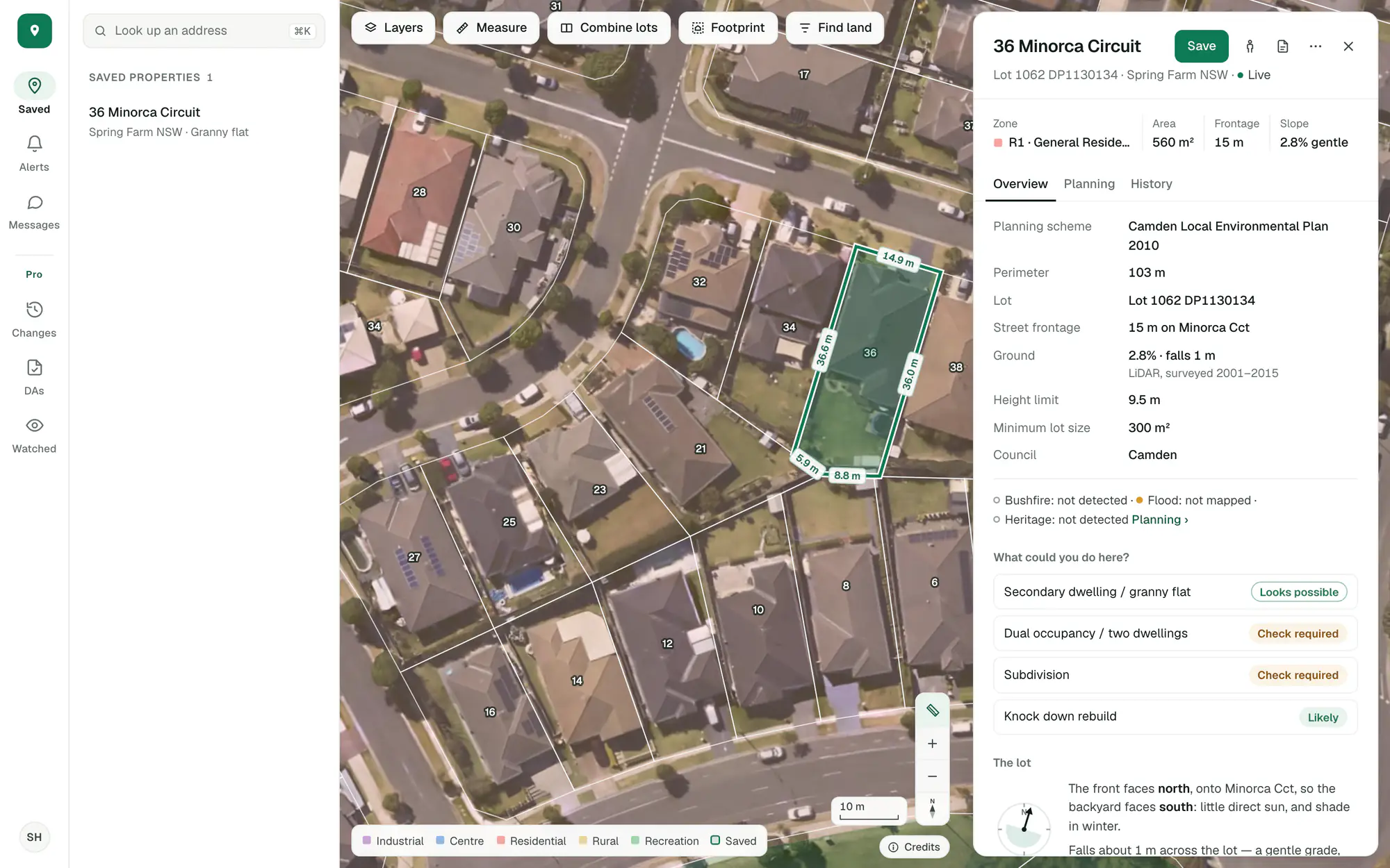
Save the lots you’re weighing up, hear when the zone or an application nearby changes, and test the site on the real lot plan: measure it and see what fits.
All it takes is your email.
The same property through five screens of the app.
Type an address or click any lot on the map. Its zone, size, street frontage and slope come up with what you could do there, checked against the live planning services.
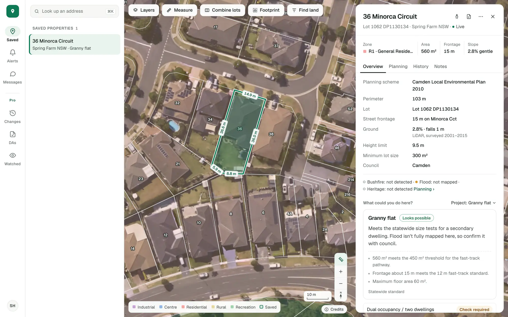
Say what you’re planning: a granny flat, a dual occupancy, a subdivision, a knockdown rebuild or any other use. You get one clear answer for it, with the figures behind it.
Place a granny flat, a house or two dwellings on the real lot plan. Turn it, resize it, and see how it sits with the setbacks.
Site tools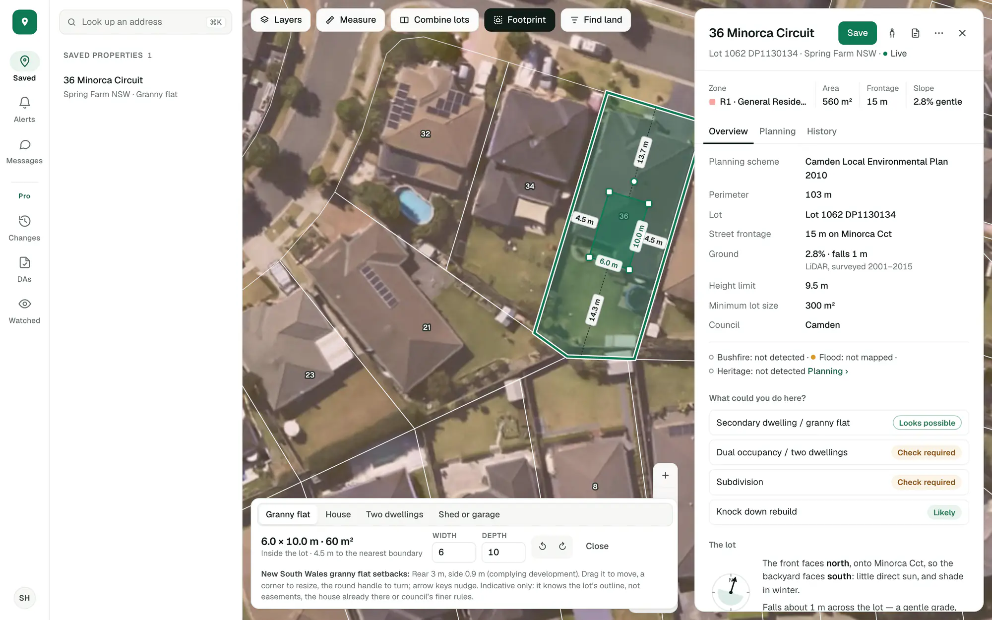
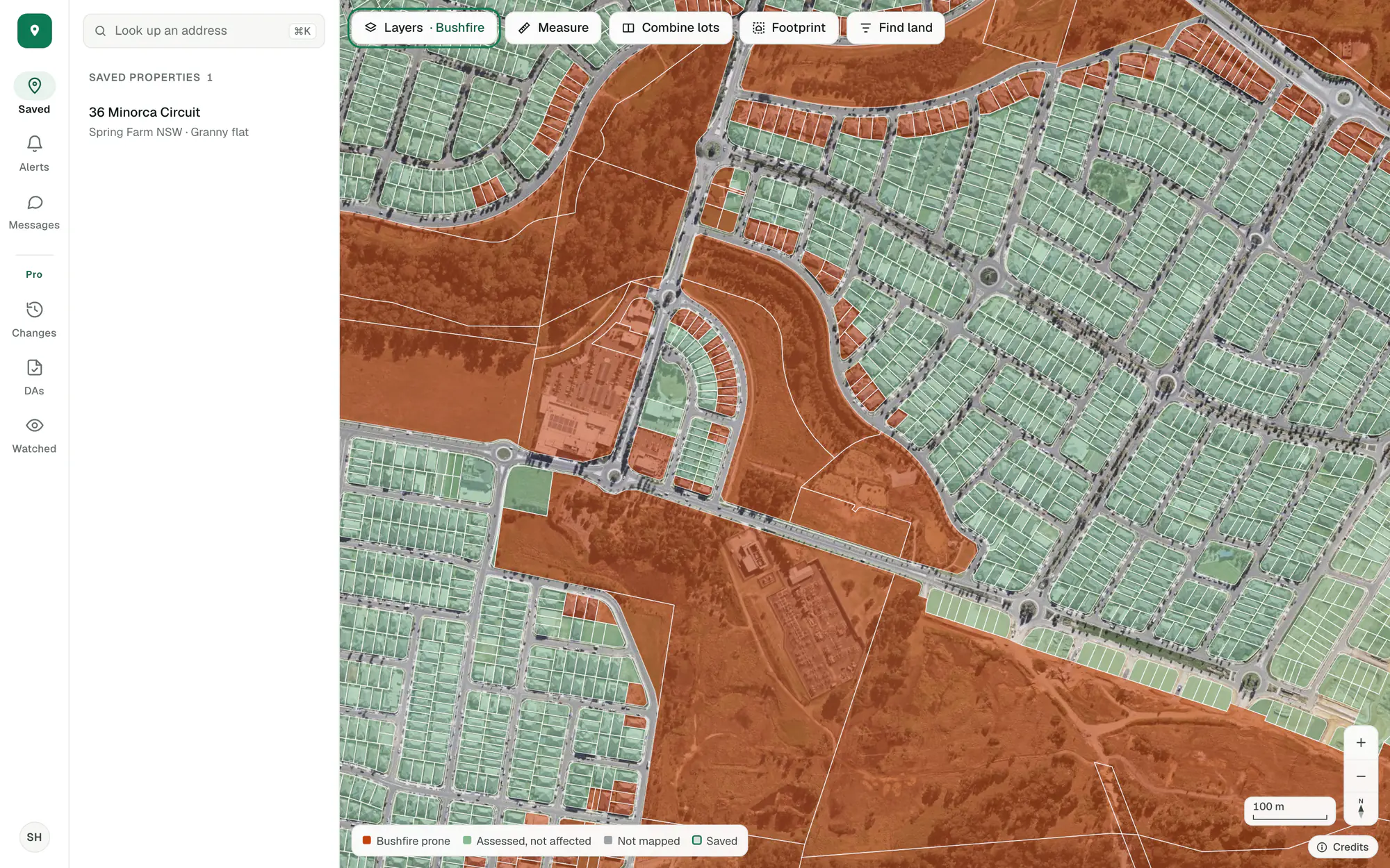
Colour the lots around you by bushfire, flood or heritage, where the state publishes them. Grey lots aren’t mapped in ZoneScout: ask the council about those.
Choose a zone and a lot size and the lots that match light up. Step through them one by one.
Find land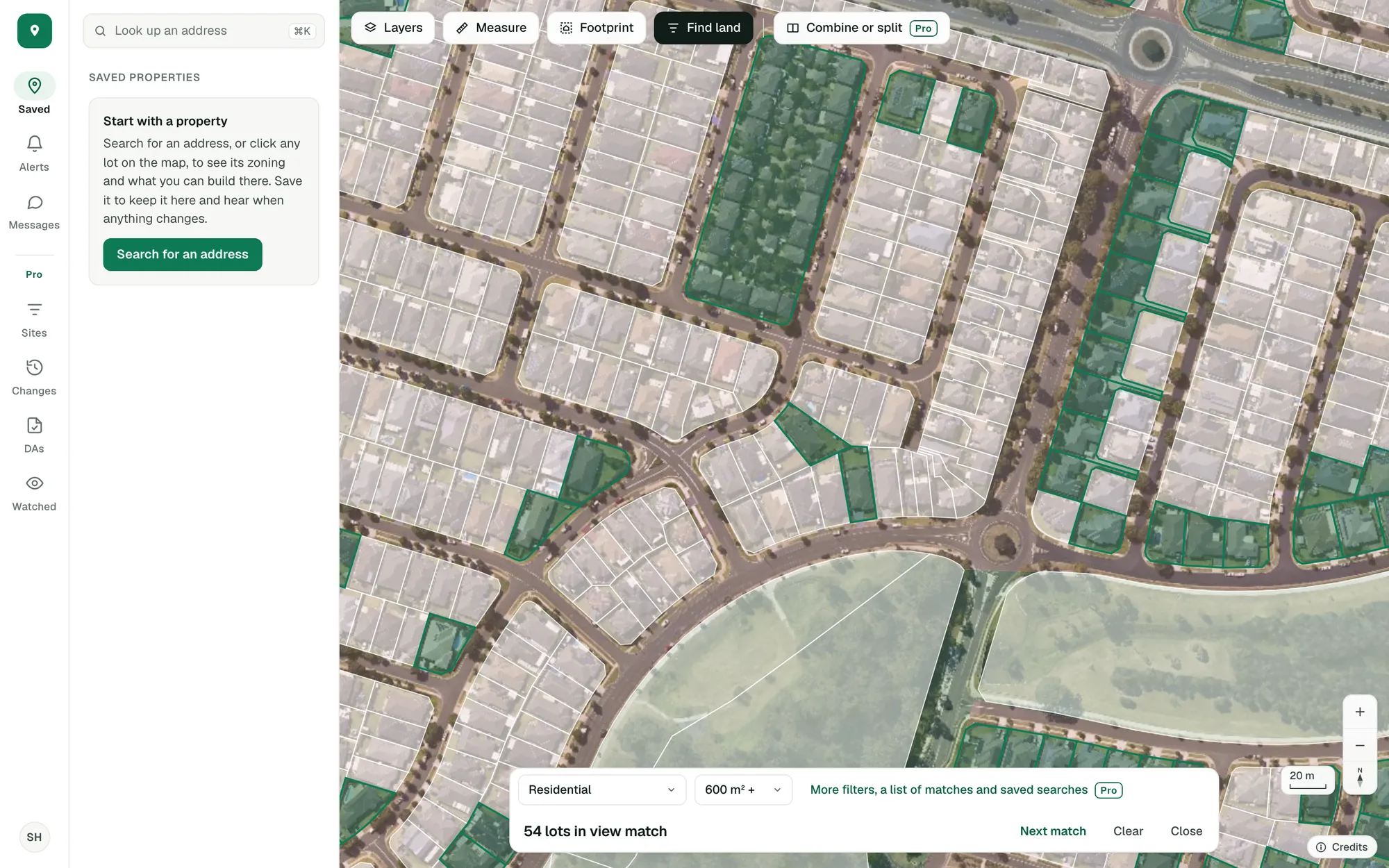
Your properties stay in one place, and we keep an eye on them for you.
One click saves a lot with your notes. From then on we check it every night and tell you about a new application nearby, a rezoning, or a change to an overlay or the planning controls.
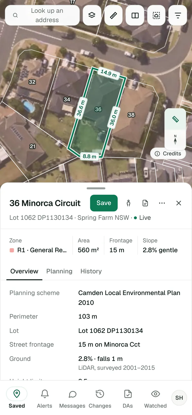
Imagery © State of NSW (Spatial Services, DCS), CC BY 4.0.
A line for a setback or a driveway, an area for a backyard or a pad, on the lot’s own boundary with every side’s length shown. Then place a building on it and see how it sits.
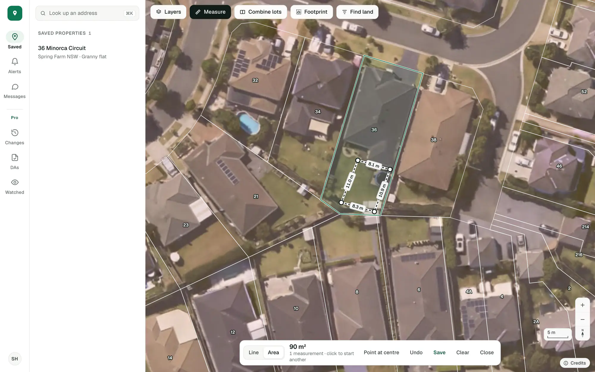
Imagery © State of NSW (Spatial Services, DCS), CC BY 4.0.
The lot plan on the aerial with every boundary length, the zone and controls, the overlays, the lot and its history, with every source named. Print it or save it as a PDF.
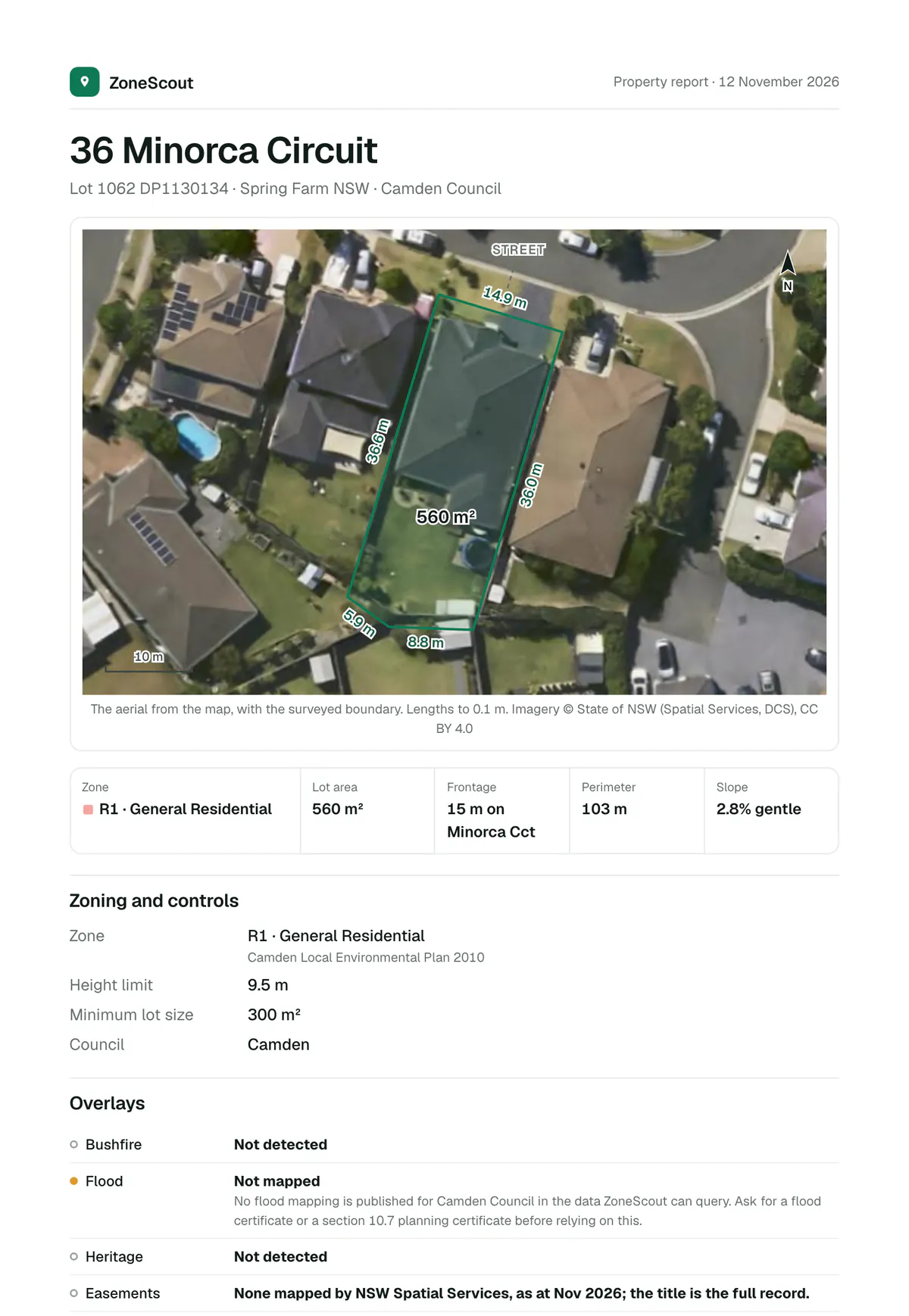
Imagery © State of NSW (Spatial Services, DCS), CC BY 4.0.
Everything about a property in one panel, kept, watched and on a map you can work on.
Every lot you’re looking at in one list, one click to save, with your own notes.
Its address, zone, size, street frontage and which way it faces, slope, easements and strata, with the height limit and minimum lot size in NSW. More
Granny flat, dual occupancy, subdivision, knockdown rebuild or any other use: what the rules say for this lot.
Applications lodged on the lot and within 200 metres, and projects like yours approved nearby. More
We check your saved properties overnight and tell you, in the app and by email, about a new application nearby, a rezoning, or a change to an overlay or the planning controls. More
Flood, bushfire, heritage and more, coloured across the lots around you, where the state publishes them.
Lines and areas on the lot plan, with each side’s length as you draw. More
Place a granny flat, a house or two dwellings on the lot, turn it, and see how it sits with the setbacks. More
Show the lots that match a zone and a lot size, and step through them one by one. More
Saved properties side by side, and the street seen from the property, without leaving the map.
A report for any property, ready to print or save as a PDF, and a read-only link to share a saved one. More
Ask us anything from inside the app, and add a screenshot when it’s easier to show than to say.
The free account is about the properties you save. Pro finds the sites, joins and splits them, and watches the land around them.
Every filter on the lots (street frontage, title, corner lots, clear overlays, room to subdivide) with each match listed beside the map and coloured by a figure. More
Count and list every lot that matches across a council, wherever the map is looking, and keep the search to come back to. More
Adjoining lots read as one site, and a site cut into parts, each with its area and street frontage beside the minimum lot size. More
Development applications on the map and in a list, with what each proposes and how it went, and years of history. More
Each week’s rezonings and new lots, on the map, in a list and in each lot’s history, so you see where land is changing first. More
Mark out the areas you work in and we check them every night, so you hear when a new application or a rezoning turns up. More
Zoning changes and applications, and the lots in view that a search matches, as a spreadsheet with addresses.
The property report with your logo and details, the sections you choose and your own wording. More
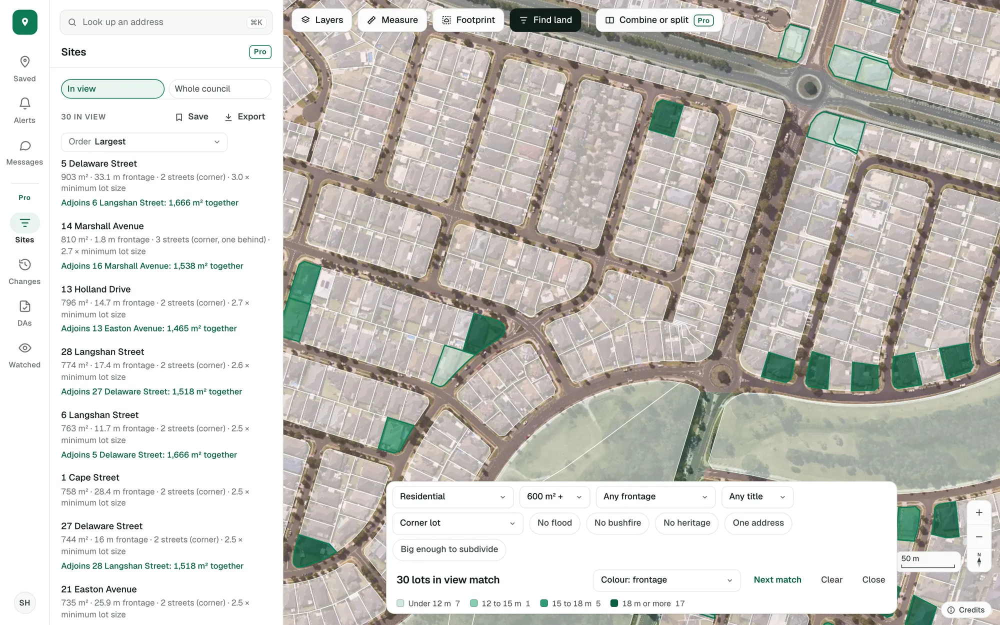
The site finder on real lots: residential corner lots of 600 m² or more around Spring Farm, coloured by street frontage. Imagery © State of NSW (Spatial Services, DCS), CC BY 4.0.
Sign up with your email and you’re in. The search, the map and the rules on this site stay free for everyone, account or not.
Your properties and notes are for you. Share a property with a link when you want a second opinion, or ask a planner to call you about it.
Delete your account in Settings whenever you like, and everything you saved goes with it. The privacy policy sets out what we keep and for how long.
Every lot and its zone in New South Wales, Victoria, Queensland, Western Australia, South Australia, Tasmania and the ACT. What’s mapped over the land, and whose applications we hold, depends on what each state and council publishes.
Yes. Sign up with your email and the free account is yours to keep: saved properties, the answer for your project, alerts, the map tools, Find land and the report. Pro’s tools are there to try free as well.
For planning, yes. Landchecker is a paid service covering a wide range of property data. If it’s the planning side you’re after (a lot’s zone and overlays, what you could build and what’s been approved nearby), ZoneScout gives you that for free, along with tools to measure the site and see what fits.
For the first look at a site, yes. Archistar is a paid platform for designing and assessing developments. ZoneScout helps you at the stage before that: what the zone and overlays allow, whether your project could fit, and what’s been approved nearby, all for free.
Pop in your email and we’ll send you a link, or continue with Google. Click the link within 15 minutes and you’re in. You won’t need a password.
Just you. You can share a property with a link whenever you like, and if you ask a planner to call, they’ll see that property. If you need help, our support team can see which properties are saved on your account, while your notes stay private to you. The privacy policy has the detail.
Yes, any time, from Settings. If you’ve signed in within the last day it’s deleted straight away; otherwise we’ll email you a link to confirm. Everything you saved goes with it, and it clears from our backups within 7 days.
Free, in a minute, with just your email.
General guidance only. ZoneScout reads published government planning data and summarises published standards. It isn’t professional planning advice.
Landchecker and Archistar are trademarks of their owners; ZoneScout is independent of both.