Combine lots, or split a site.
Click adjoining lots to read them as one site, then cut it into parts and see each part’s area and frontage beside the minimum lot size.
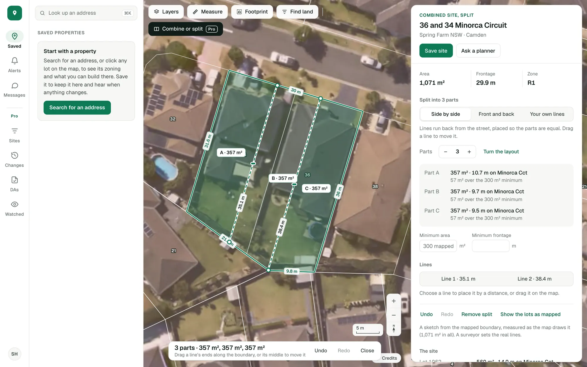
34 and 36 Minorca Circuit, Spring Farm, combined and split in three.Imagery © State of NSW (Spatial Services, DCS), CC BY 4.0.
A site is whatever you pick: one lot, or up to 20 that adjoin, read as one.
Side by side or front and back, the parts are placed to be equal in area, whatever the shape of the land.
Each part’s area and frontage beside the minimum. Whether it can be subdivided is the council’s to say.
Combine adjoining lots into one site.
Click adjoining lots and they become one site with its own card: the area and each street’s frontage added up, the zones, the easements, the planning controls and the overlays across the lots.
- On these two: 1,071 m², 29.9 m of street frontage, all R1 General Residential
- Similar applications nearby, on the same card
- Ask a planner about the site as it stands
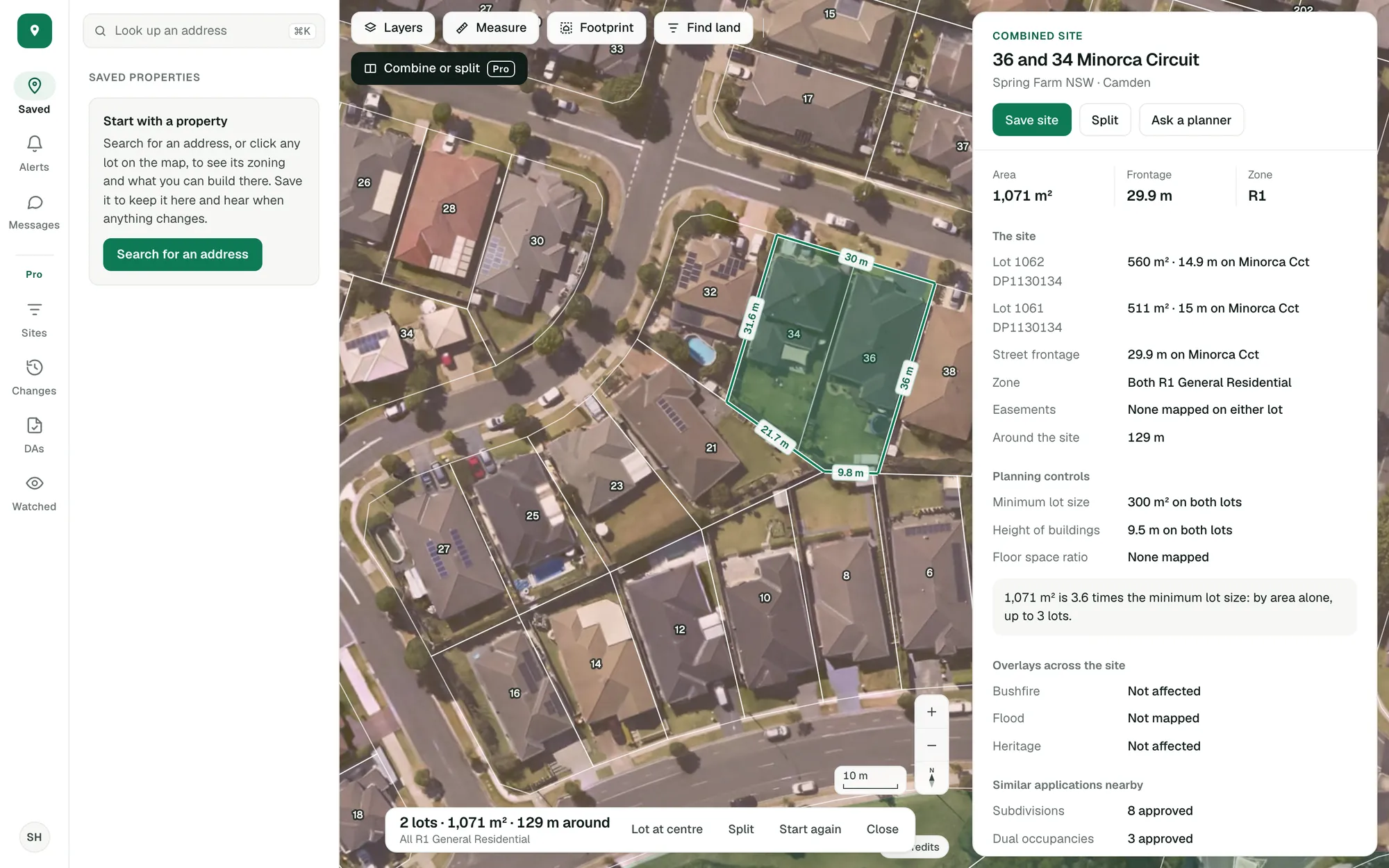
Imagery © State of NSW (Spatial Services, DCS), CC BY 4.0.
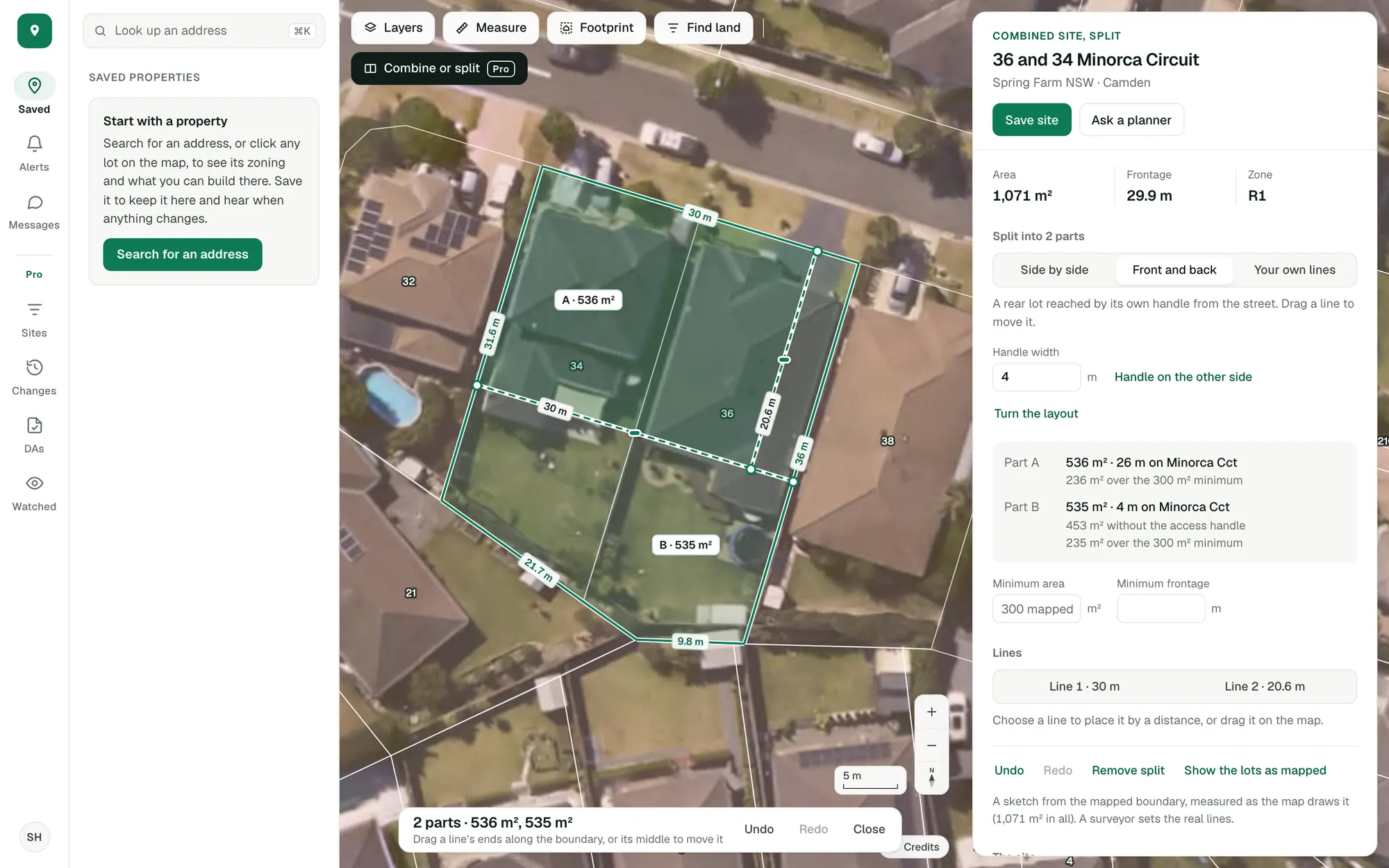
Three ways to split a site.
Side by side, with lines running back from the street. Front and back, a rear lot reached by its own handle. Or your own lines, drawn from one side of the site to another.
- Two to six equal parts
- A handle of 4 metres to begin with, down either side
- Turn the layout to run from a corner site’s other street
Imagery © State of NSW (Spatial Services, DCS), CC BY 4.0.
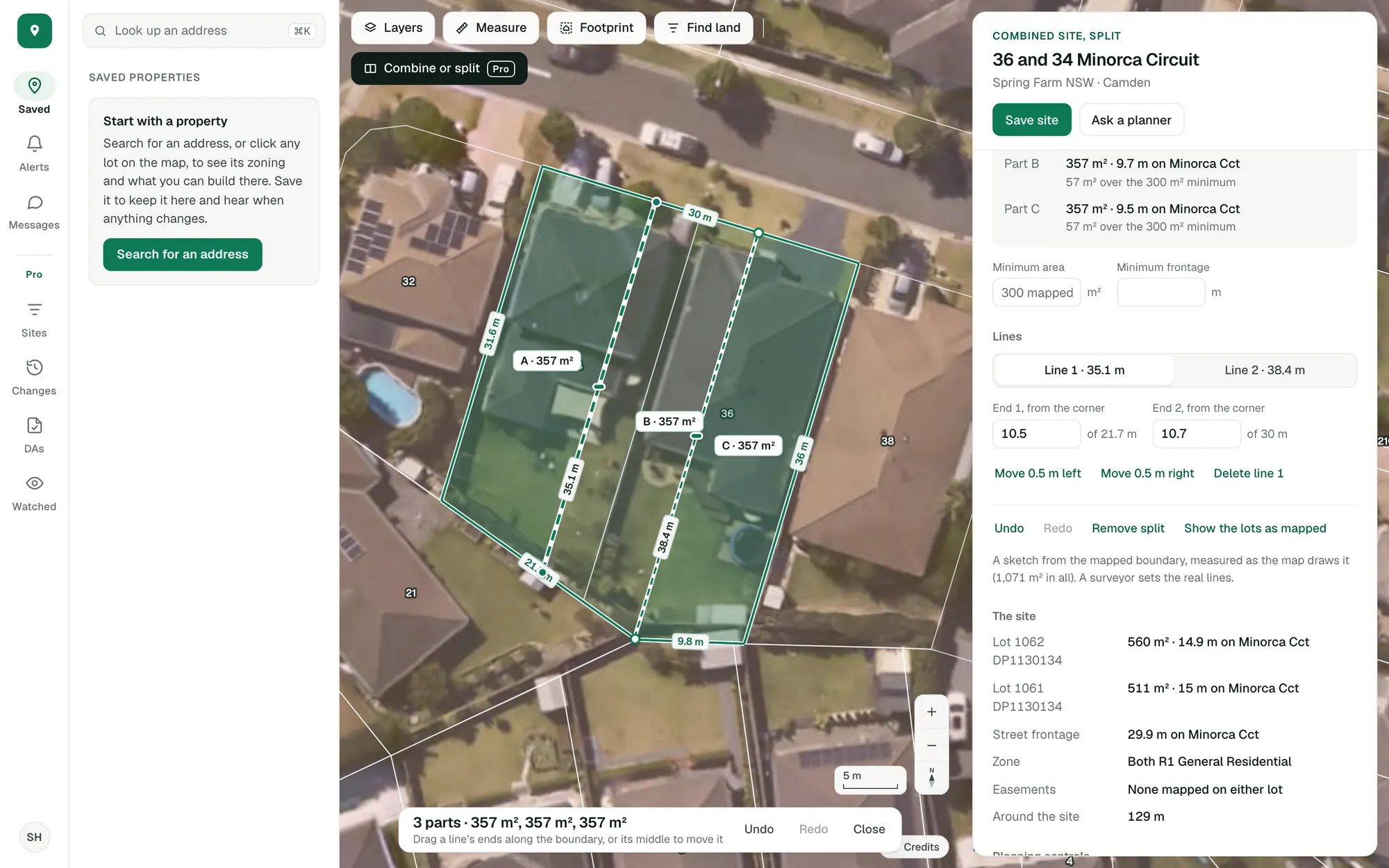
Move a line exactly where you want it.
Drag a line’s ends along the boundary or its middle to shift it, nudge it half a metre at a time, or type its distance from the corner. Every part’s area follows as you go.
- Squares to the boundary as you drag
- Undo and redo
- Lines run across the old boundary between the lots
Imagery © State of NSW (Spatial Services, DCS), CC BY 4.0.
Compare each part with the minimum lot size.
Each part shows its area and street frontage against the minimum lot size mapped for the site, or against a minimum area and frontage of your own, in any state.
- “357 m² · 10.7 m on Minorca Cct: 57 m² over the 300 m² minimum”
- A rear lot’s area with and without its handle
- A sketch from the mapped boundary: a surveyor sets the real lines
Imagery © State of NSW (Spatial Services, DCS), CC BY 4.0.
Combine or split is Pro. A saved site keeps its split, and opens again as you left it.
Try it on a site you know.
Create an account with your email and Pro’s tools are in the app to try.
General guidance only. ZoneScout reads published government planning data and summarises published standards. It isn’t professional planning advice.