The app/For professionals
For people who work with land.
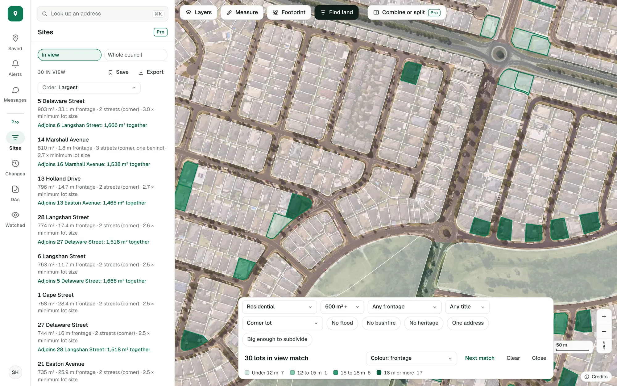
A first look at a site: what it is, what could go there, what’s been approved around it and what’s changing nearby. For buyers’ agents, developers, builders, designers and planners.
Imagery © State of NSW (Spatial Services, DCS), CC BY 4.0.
What you’d use it for.
Buyers’ agents and investors
Shortlist faster, and know what a block can do before you inspect it.
- The site finder: zone, size, frontage and corner lots
- Compare saved properties side by side
- Alerts when a saved lot or its street changes
- A report to send a client
Developers and builders
Find the site, test the yield, and see what council has approved around it.
- Every match across a council, with its reasons
- Combine lots and split the site, part by part
- Similar applications nearby, and how long it took
- New lots and rezonings, week by week
Planners and designers
The facts of a lot in one panel, each with its source.
- The zone, its scheme and what the land use table allows
- Overlays said as they are mapped: affected, not affected or not mapped
- Footprint: will it fit, with the setbacks
- Your own report, with your brand
Where every figure comes from.
Every figure comes from a government source and says which one. Where a source doesn’t cover a lot, the app says so.
You can see what isn’t mapped.
An overlay shows where a government has mapped that hazard. Where nobody has, the lot is grey and the panel says not mapped, so you know to ask the council.
Data and coverage, state by state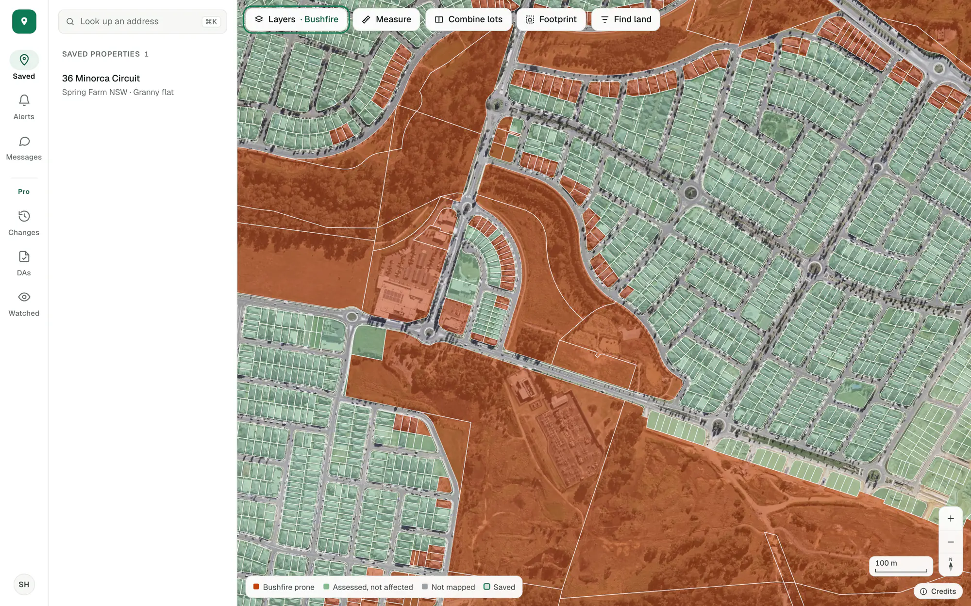
Imagery © State of NSW (Spatial Services, DCS), CC BY 4.0.
Checked against the live planning services.
Opening a lot asks the planning services about it there and then. Saving it keeps what was found and watches it for changes from that night.
Alerts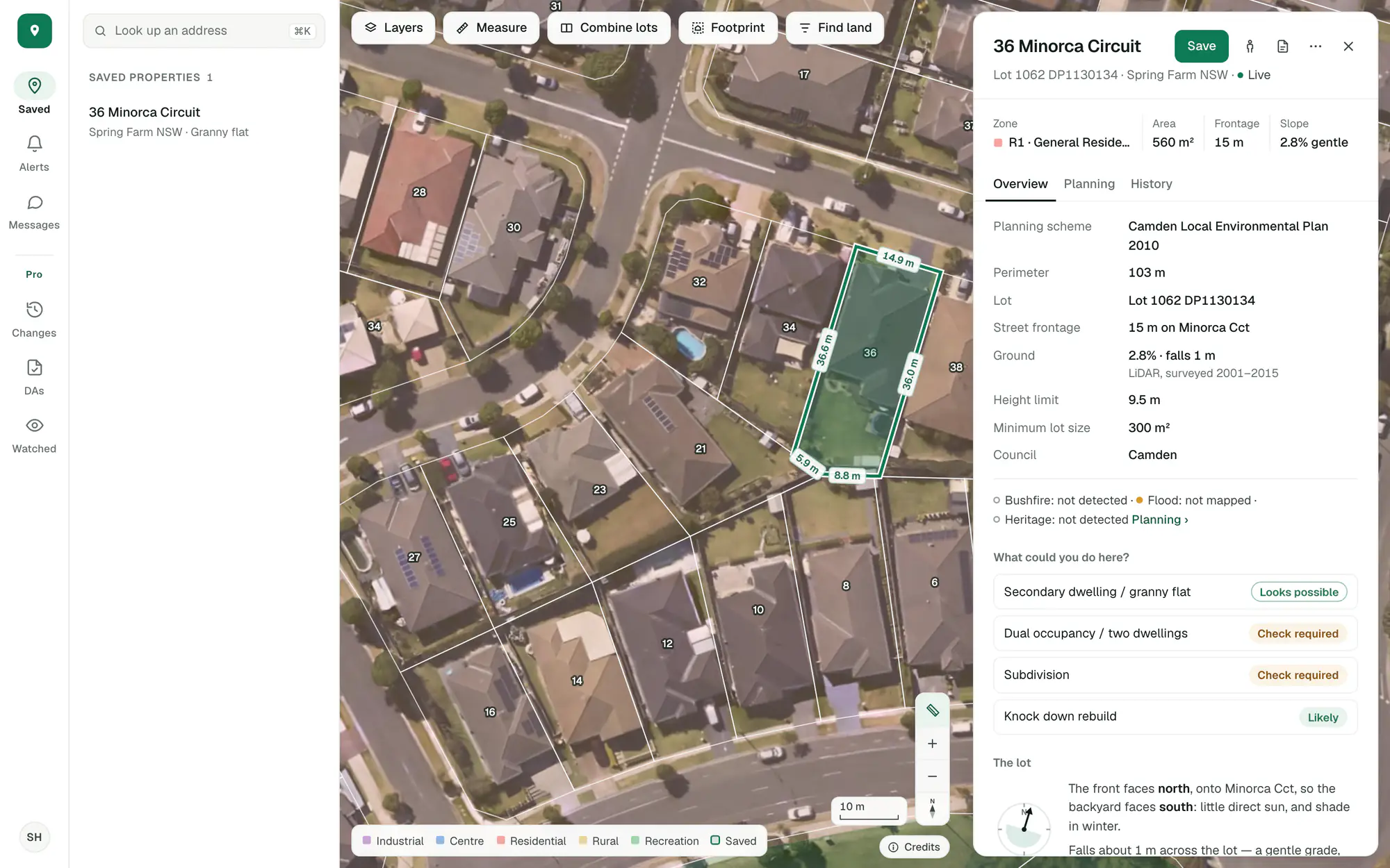
Imagery © State of NSW (Spatial Services, DCS), CC BY 4.0.
Pro is where the work tools are.
The site finder, combine and split, the development applications map, zoning changes, watched areas, exports and your own report.
Site finder
Every filter on the lots (street frontage, title, corner lots, clear overlays, room to subdivide) with each match listed beside the map and coloured by a figure. More
A whole council at once
Count and list every lot that matches across a council, wherever the map is looking, and keep the search to come back to. More
Combine or split
Adjoining lots read as one site, and a site cut into parts, each with its area and street frontage beside the minimum lot size. More
Development applications map
Development applications on the map and in a list, with what each proposes and how it went, and years of history. More
Zoning changes
Each week’s rezonings and new lots, on the map, in a list and in each lot’s history, so you see where land is changing first. More
Watched areas
Mark out the areas you work in and we check them every night, so you hear when a new application or a rezoning turns up. More
Exports
Zoning changes and applications, and the lots in view that a search matches, as a spreadsheet with addresses.
Your own report
The property report with your logo and details, the sections you choose and your own wording. More
Open your first site.
Free, in a minute, with just your email.
General guidance only. ZoneScout reads published government planning data and summarises published standards. It isn’t professional planning advice.